Maritime awareness
Beyond AIS: Building a More Complete Maritime Picture
Radar, AIS, cameras and vessel behaviour can give security teams better evidence and more time to respond.
David Voigts7 min read
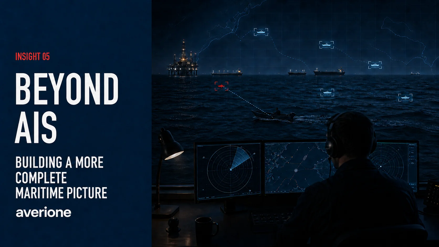
If a security team relies on the Automatic Identification System (AIS) alone, a boat can approach an offshore asset (a platform, island or another vessel) without appearing on its vessel-tracking map. The team protecting the asset needs to detect approaching boats early enough to assess their behaviour and respond when necessary.
Illustrative case study
Consider an offshore security programme designed to protect fixed assets in waters used by thousands of boats. Many are small fishing vessels that are not required to use the Automatic Identification System, or AIS. Some crews may also switch off their AIS equipment.
AIS broadcasts a vessel’s reported identity, position, course and speed over VHF radio. A receiver passes those reports to a tracking display, which plots the positions on a map. In this case, the map shows only boats whose AIS position reports the system receives. The team must also account for boats absent from the display, including those whose crews may be trying to avoid tracking.
The security team cannot assume that every vessel on the display is reporting accurate information. The US Coast Guard describes cases where two vessels broadcast the same Maritime Mobile Service Identity (MMSI) number. This can make the displayed position appear to jump between the two boats. The International Maritime Organization’s guidance makes the limits clear: some craft do not carry AIS, crews may switch it off, and received reports may contain inaccurate information.
Because AIS cannot provide a complete picture of nearby traffic, the security team needs radar to detect boats independently of their transmissions. Radar transmits radio waves and receives energy reflected by objects. It can therefore detect a boat that is not transmitting AIS, provided the reflected signal can be distinguished from background returns.
Detection must give the security team enough warning to respond before a boat reaches the protected asset. At this site, radar coverage must allow time to assess the boat’s movements, contact its crew and choose a response. That warning time should guide the choice of equipment.
Radar technology
For a small area, a standard marine radar may provide that warning. A complex system is not needed simply because it’s available. The radar selected must reliably track the boats of concern early enough for the security team to respond.
That task becomes harder when security teams must monitor hundreds of square kilometres of open water. Waves, spray and rain also reflect radar energy. Echoes from the sea, known as sea clutter, can mask the reflected signal from a small boat. A fishing boat, rigid inflatable boat or low-profile workboat may therefore be difficult to detect. A boat may be within the radar’s stated range while its echo remains too weak to distinguish from sea clutter. The echo’s strength therefore affects the warning time available.
This is why buyers need to examine the target assumptions behind a stated detection range. An archived coastal-radar specification quotes a detection range of 20 kilometres for a small boat, rubber dinghy or jet ski. That range assumes a target with a radar cross-section of 1.5 square metres.
Radar cross-section describes how strongly an object reflects energy back towards the radar. It is not a measure of the boat’s size. Material, structure and the angle of the hull all affect the echo. A large wooden or fibreglass boat can therefore be harder to detect than a smaller metal one. Buyers need to compare the specified target with the boats the site must detect.
Radar signal processing can help separate a weak boat echo from the returns caused by waves and spray. Some modern marine radars already include automatic boat tracking and clutter reduction as standard functions. The test is whether the radar can reliably track the smallest boats of concern at the required distance and under expected sea conditions.
Where these functions are insufficient, specialist systems offer other ways to detect weak boat echoes. Doppler processing can help separate a moving boat’s echo from sea clutter. Adaptive filters adjust clutter suppression as conditions change. A method called track-before-detect combines several weak observations over time to build confidence that a boat or other target is present. Purpose-built coastal radars are also available to detect small craft, including kayaks and rigid inflatable boats.
Processing a weak signal is only part of the challenge. The boat must also be within the radar’s line of sight, which makes antenna height important. A boat that sits low in the water can be hidden beyond the radar’s horizon. Where the radar horizon limits detection, raising the antenna may help more than increasing transmitter power.
The IMO radar performance standard notes that real-world range also depends on a target’s speed and orientation, atmospheric conditions and sea state. A quoted range alone therefore cannot establish how much warning the team will receive. Coverage planning must account for the boats, the site and expected operating conditions.
Security response
Tracking a boat early gives the security team time to assess its movements. Neither the track nor the absence of an AIS report establishes hostile intent; the team needs to consider the boat’s behaviour and other evidence. Radar tracking provides the boat’s position, estimated speed, direction of travel and track history. AIS may supply a reported identity. A daylight camera or a thermal camera, which forms images from infrared radiation, can provide visual evidence of the boat’s activity. Together, these sources help the security team compare the boat’s movements with what is normal or expected at the site.
Consider a small wooden boat moving slowly through a known fishing area. It turns back across its route and stops from time to time. Those movements may suggest a crew working nets, making the boat a lower priority for investigation even without AIS.
By comparison, a boat approaching rapidly on a direct course towards a group of platforms or a tanker calls for closer attention. Large containers visible on deck may warrant further assessment, but they do not prove an intention to steal oil. Their significance depends on the boat’s route, behaviour and the other evidence available.
These examples show why behaviour must be judged in context. With thousands of boats in the area, security teams need help identifying those that warrant further assessment. Automated checks can flag movements for review: the European Maritime Safety Agency uses automated behaviour monitoring to flag drifting, sudden changes in speed or course, gaps in reporting and transfers between ships. Artificial intelligence, or AI, can also help assess risk using patterns learned from normal traffic. The system can update a boat’s risk score as new observations arrive, but the security team must understand the evidence behind the score.
At an offshore site, these checks must also consider the time of day, the boat’s earlier movements and expected arrivals. Site-specific alert rules could assign an amber status when a boat crosses an outer monitoring boundary. The alert could escalate to red if the boat crosses an inner boundary without slowing, its crew does not answer a radio call and its arrival is not scheduled. The warning must show which observations triggered the escalation and what the security team should check next. Early detection gives the security team time to review that evidence and choose a response.
Start with the security need
When people ask which radar to buy, I start with the area to monitor, expected sea conditions, boats to detect and time needed to respond. The boats missing from the AIS map define part of the problem. The time needed to assess and respond to them defines the warning the system must provide. Those requirements should guide the radar choice from the start. A more complete maritime picture brings radar, AIS, cameras and vessel behaviour together so the security team can decide when and how to respond.